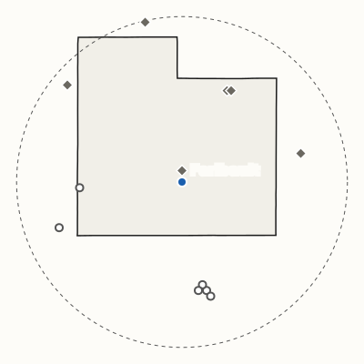
Friday, Dec. 20, 2024
Storm log
Storm Log
Every National Weather Service warning for Rice County and every storm report within 20 miles of Faribault, day by day.
Warnings for Rice County
- 59 tornado warnings since 1987
- 342 severe thunderstorm warnings since 1986
- 70 flood warnings since 1990
- 98 winter warnings since 2006
How long since
- Last tornado warning June 23, 2026, 133 days ago
- Last severe thunderstorm warning Oct. 28, 2026, 6 days ago
- Last hail in Faribault April 13, 2026, 204 days ago
- Last tornado within 20 miles Aug. 29, 2025, 431 days ago
Warning: Issued when hazardous weather is happening, about to happen or very likely, and is a threat to life or property. National Weather Service glossary
Storm report: A local storm report: what a local National Weather Service office issues to share reports of severe or significant weather. National Weather Service glossary
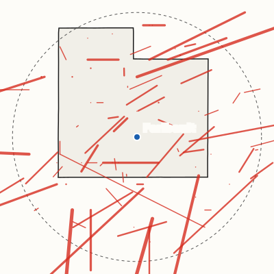
The area this log covers
Every National Weather Service warning for Rice County (outlined) and every storm report inside the dashed circle, 20 miles around Faribault (the blue dot).
- Tornado
- Hail, 1 inch or more
- Wind, 58 mph or damage
- Flood, or 6 inches of snow
- Any other report
- Tornado warning
- Severe thunderstorm warning
- Flash flood or flood warning
Current through Nov. 3
Follow new storm days in a feed reader: the storm-day feed (Atom), the 20 newest.
14 storm days in Faribault in 2024
December 2 storm days in Faribault
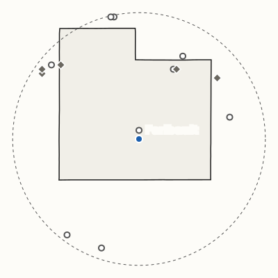
Thursday, Dec. 19, 2024
4.3 inches of snow in Faribault under a winter storm warning
Largest snow within 20 miles: 7.3 in., 1 mile north of Montgomery
- Winter storm warning, 6:51 a.m. to midnight Dec. 20
August 1 storm day in Faribault
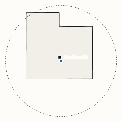
Thursday, Aug. 29, 2024
Wind damage in Faribault
July 1 storm day in Faribault
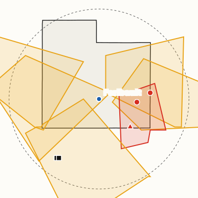
Saturday, July 13, 2024
Tornado 6 miles east-northeast of Medford; tornado warning nearby
6 warnings
- Severe thunderstorm warning, 4:11 to 4:45 p.m. (Faribault outside)
- Severe thunderstorm warning, 4:41 to 5:15 p.m. (Faribault outside)
- Severe thunderstorm warning, 4:44 to 5:30 p.m. (Faribault outside)
- Tornado warning, 4:58 to 5:18 p.m. (Faribault outside)
- Severe thunderstorm warning, 5:14 to 6 p.m.
- Severe thunderstorm warning, 5:52 to 6:08 p.m. (Faribault outside)
June 4 storm days in Faribault
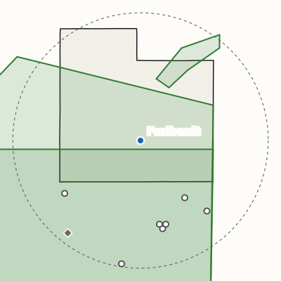
June 21 to 22, 2024
Flooding in Waseca; Faribault under a flash flood warning
4 warnings
- June 21: Flood warning, 2:29 p.m. to 2:15 a.m. June 22 (Faribault outside)
- June 21: Flood warning, 4:20 p.m. to 7 a.m. July 4 (Faribault outside)
- June 21: Flash flood warning, 10:09 p.m. to 4 a.m. June 22
- June 22: Flood warning, 2:29 a.m. to 10 a.m. June 25
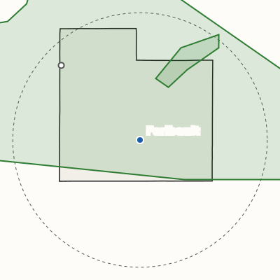
Monday, June 3, 2024
2.83 inches of rain 3 miles east-northeast of Montgomery; Faribault under a flood warning
- Flood warning, 4:21 a.m. to 11:43 a.m. June 5 (Faribault outside)
- Flood warning, 4:59 a.m. to 10 p.m.
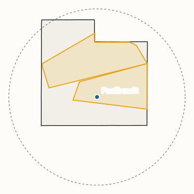
Sunday, June 2, 2024
Faribault under a severe thunderstorm warning
- Severe thunderstorm warning, 6:07 to 6:45 p.m. (Faribault outside)
- Severe thunderstorm warning, 6:29 to 7 p.m.
May 1 storm day in Faribault
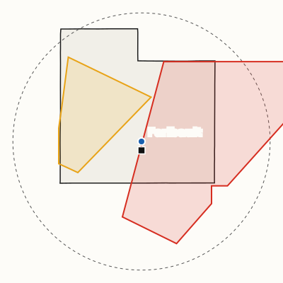
Tuesday, May 21, 2024
Wind damage in Faribault; tornado warning nearby
- Severe thunderstorm warning, 12:18 to 12:45 a.m. (Faribault outside)
- Tornado warning, 4:50 to 5:11 p.m. (Faribault outside)
March 2 storm days in Faribault
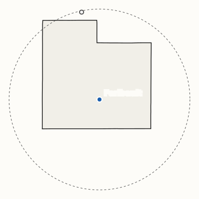
March 24 to 25, 2024
5.5 inches of snow 1 mile west of Elko New Market; Faribault under a winter storm warning
- March 24: Winter storm warning, 10 a.m. to 1 a.m. March 25
February 1 storm day in Faribault
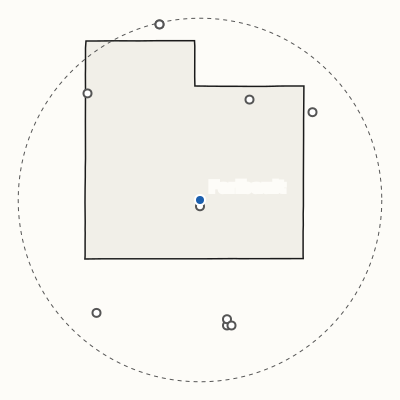
Thursday, Feb. 15, 2024
4.8 inches of snow in Faribault
Largest snow within 20 miles: 5.5 in., 1 mile west of Elko New Market
January 2 storm days in Faribault
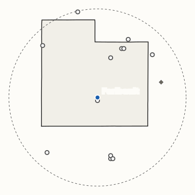
Saturday, Jan. 13, 2024
2.5 inches of snow in Faribault
Largest snow within 20 miles: 6.6 in., 4 miles east of Nerstrand
Friday, Jan. 12, 2024
Faribault under a winter storm warning
- Winter storm warning, midnight to 2:05 p.m.
Average of 2007-2025; the band is the middle 8 in 10 of those years. Storm days: a warning for Rice County or a storm report within 20 miles.
| Year | J | F | M | A | M | J | J | A | S | O | N | D |
|---|---|---|---|---|---|---|---|---|---|---|---|---|
| 2026 | 0 | 0 | 0 | 2 | 0 | 1 | 1 | 0 | 1 | 1 | 0 | |
| 2025 | 0 | 0 | 1 | 2 | 2 | 3 | 3 | 4 | 1 | 0 | 0 | 0 |
| 2024 | 0 | 0 | 0 | 0 | 2 | 7 | 2 | 4 | 1 | 0 | 0 | 0 |
| 2023 | 0 | 0 | 0 | 0 | 0 | 1 | 4 | 3 | 0 | 1 | 0 | 0 |
| 2022 | 0 | 0 | 0 | 2 | 4 | 1 | 1 | 1 | 0 | 0 | 0 | 0 |
| 2021 | 0 | 0 | 1 | 1 | 3 | 2 | 0 | 3 | 1 | 0 | 0 | 1 |
| 2020 | 0 | 0 | 0 | 0 | 2 | 2 | 3 | 4 | 1 | 0 | 0 | 0 |
| 2019 | 0 | 0 | 0 | 3 | 0 | 1 | 6 | 3 | 2 | 1 | 0 | 0 |
| 2018 | 0 | 0 | 0 | 0 | 5 | 1 | 0 | 3 | 4 | 0 | 0 | 0 |
| 2017 | 0 | 0 | 1 | 0 | 3 | 4 | 3 | 2 | 1 | 0 | 0 | 0 |
| 2016 | 0 | 0 | 0 | 1 | 0 | 5 | 4 | 4 | 2 | 0 | 1 | 0 |
| 2015 | 0 | 0 | 0 | 0 | 2 | 2 | 3 | 0 | 1 | 0 | 0 | 0 |
| 2014 | 0 | 0 | 0 | 1 | 3 | 4 | 1 | 2 | 1 | 0 | 0 | 0 |
| 2013 | 0 | 0 | 0 | 0 | 1 | 5 | 2 | 0 | 0 | 0 | 0 | 0 |
| 2012 | 0 | 0 | 1 | 0 | 6 | 7 | 2 | 3 | 0 | 0 | 0 | 0 |
| 2011 | 0 | 0 | 0 | 1 | 5 | 1 | 5 | 3 | 0 | 0 | 0 | 0 |
| 2010 | 0 | 0 | 0 | 1 | 1 | 3 | 3 | 2 | 3 | 0 | 0 | 0 |
| 2009 | 0 | 0 | 0 | 0 | 0 | 1 | 1 | 1 | 0 | 0 | 0 | 0 |
| 2008 | 0 | 0 | 0 | 0 | 2 | 2 | 5 | 1 | 0 | 0 | 0 | 0 |
| 2007 | 0 | 0 | 2 | 1 | 1 | 3 | 2 | 5 | 1 | 1 | 0 | 0 |
Thunderstorm days in each month, 2007 through 2026 (this year so far): days with a tornado, severe thunderstorm or flash flood warning for Rice County, or a hail, tornado, funnel cloud, thunderstorm wind, flash flood or rain report within 20 miles (rain only from April through October). 1 or 2, 3 or more, one scale for both strips. The average is of 2007 to 2025.
| Year | J | F | M | A | M | J | J | A | S | O | N | D |
|---|---|---|---|---|---|---|---|---|---|---|---|---|
| 2026 | 1 | 3 | 3 | 1 | 0 | 0 | 0 | 0 | 0 | 0 | 0 | |
| 2025 | 0 | 1 | 3 | 0 | 0 | 0 | 0 | 0 | 0 | 0 | 4 | 4 |
| 2024 | 3 | 1 | 3 | 0 | 0 | 0 | 0 | 0 | 0 | 0 | 0 | 2 |
| 2023 | 5 | 4 | 4 | 2 | 0 | 0 | 0 | 0 | 0 | 0 | 0 | 0 |
| 2022 | 3 | 1 | 0 | 0 | 0 | 0 | 0 | 0 | 0 | 0 | 2 | 5 |
| 2021 | 4 | 1 | 2 | 0 | 0 | 0 | 0 | 0 | 0 | 0 | 0 | 4 |
| 2020 | 3 | 4 | 0 | 2 | 0 | 0 | 0 | 0 | 0 | 2 | 1 | 3 |
| 2019 | 3 | 10 | 3 | 4 | 0 | 0 | 0 | 0 | 0 | 0 | 3 | 0 |
| 2018 | 5 | 2 | 3 | 5 | 0 | 0 | 0 | 0 | 0 | 0 | 1 | 3 |
| 2017 | 3 | 2 | 2 | 0 | 0 | 0 | 0 | 0 | 0 | 0 | 0 | 2 |
| 2016 | 1 | 2 | 2 | 0 | 0 | 0 | 0 | 0 | 0 | 0 | 1 | 4 |
| 2015 | 1 | 1 | 3 | 0 | 0 | 0 | 0 | 0 | 0 | 0 | 1 | 4 |
| 2014 | 6 | 5 | 3 | 2 | 0 | 0 | 0 | 0 | 0 | 0 | 2 | 1 |
| 2013 | 2 | 3 | 7 | 6 | 3 | 0 | 0 | 0 | 0 | 0 | 1 | 1 |
| 2012 | 1 | 3 | 0 | 0 | 0 | 0 | 0 | 0 | 0 | 0 | 0 | 5 |
| 2011 | 1 | 2 | 2 | 0 | 0 | 0 | 0 | 0 | 0 | 0 | 0 | 3 |
| 2010 | 1 | 5 | 0 | 0 | 0 | 0 | 0 | 0 | 0 | 0 | 2 | 10 |
| 2009 | 4 | 3 | 2 | 1 | 0 | 0 | 0 | 0 | 0 | 1 | 0 | 9 |
| 2008 | 1 | 2 | 3 | 1 | 0 | 0 | 0 | 0 | 0 | 0 | 0 | 8 |
| 2007 | 3 | 6 | 3 | 0 | 0 | 0 | 0 | 0 | 0 | 0 | 0 | 1 |
Winter storm days in each month, 2007 through 2026 (this year so far): days with a winter storm, blizzard or heavy snow warning for Rice County, or a snow or ice report within 20 miles. A day can be in both strips. 1 or 2, 3 or more, one scale for both strips. The average is of 2007 to 2025.
37 storm days since 2007 are in neither strip, mostly flood warnings and non-thunderstorm wind. They count everywhere else on this page.
| Hour | Warnings |
|---|---|
| midnight | 18 |
| 1 a.m. | 8 |
| 2 a.m. | 11 |
| 3 a.m. | 12 |
| 4 a.m. | 6 |
| 5 a.m. | 4 |
| 6 a.m. | 8 |
| 7 a.m. | 3 |
| 8 a.m. | 10 |
| 9 a.m. | 10 |
| 10 a.m. | 4 |
| 11 a.m. | 4 |
| noon | 7 |
| 1 p.m. | 14 |
| 2 p.m. | 11 |
| 3 p.m. | 31 |
| 4 p.m. | 45 |
| 5 p.m. | 35 |
| 6 p.m. | 47 |
| 7 p.m. | 47 |
| 8 p.m. | 32 |
| 9 p.m. | 25 |
| 10 p.m. | 30 |
| 11 p.m. | 16 |
Tornado, severe thunderstorm and flash flood warnings for Rice County since 1986, by the hour each was issued, in Faribault's time; the two busiest hours darker.
Tracks within 20 miles since 1950, Storm Prediction Center